Advnture Verdict
This GPS hiking app makes it easy to discover and research routes wherever you are in the world, with handy functions like current weather conditions and downloadable 3D maps to help plan your hike. Once you're on the trail, you can alert your emergency contacts to your location and receive wrong turn notifications if you stray off the path. The only thing we'd like to see in future updates is interactive maps so we can explore interesting waypoints on our next hike.
Pros
- +
Easy to use
- +
450k routes worldwide
- +
Feature-rich including Live Share with emergency contacts
- +
Downloadable 3D maps
- +
Wrong turn alerts
- +
Lots of activities
- +
Great community features
- +
1% for the Planet member
Cons
- -
3D maps aren't interactive
- -
Smartwatch integration isn't the best
You can trust Advnture
AllTrails+: first impressions
AllTrails has been around since 2010, long enough to collect 450,000 verified routes across the world, but recent upgrades via its subscription-based AllTrails+ membership reveal a commitment to becoming essential for hikers and walkers everywhere. This navigation app was named Apple's iPhone App of the Year in 2023 and a suite of upgrades they've rolled out since then prove that they're positioning themselves as the most comprehensive and user-friendly app out there for hikers.
Anyone can download the AllTrails app for free and search for trails, finding details such as distance, difficulty and attractions, but for $35.99 a year, AllTrails+ subscribers unlock a whole host of additional features, such as searching for trails by distance from you, route preview, weather along the trail, route conditions and even mosquito activity so you know whether or not you need your insect repellent. Though it's primarily a hiking app, you can select from a long list of activities including trail running, cross country skiing and mountain biking and navigate and track your activities.
• RRP: $35.99 / £35.99 (free version available)
• Platforms: iOS, Android, browser
• GPS: Yes
• Device pairing: Pairs with most smartphones and smartwatches that can download GPX files
• Download: AllTrails.com
• Best use: Hiking, running, biking
With both the free and paid versions, you can search for a trail using filters which group hikes into Collections with titles like epic views, among the trees or waterfalls. When you find a trail you like the look of, only AllTrails+ users can download the map for offline use which means you can save on battery life and avoid annoying pings while you're hiking (not to mention the fact that the best hiking spots have zero cell service). Hit start when you reach the trailhead then follow the prompts to stay on course. With the paid version, you can even live share your location with loved ones and if you take a wrong turn, your phone or device will alert you.
At the end of each hike, you'll be given a roundup of stats such as calories burned, pace and elevation gain and be prompted to rate the trail and share comments and photos so that other hikers can benefit. This feature is available to all AllTrails users and helps keep trail information current. The smartwatch integration isn't great and the 3D maps aren't interactive, so if you see an interesting landmark on the map, you can't tap on it to learn more, but we're struggling to come up with much we don't like about this route-finding app.
All in all, a lot of the great aspects of AllTrails such as the incredible array of features and GPS tracking are available for free, but for just $3 a month, you can get pertinent details about a trail and hike with confidence.
AllTrails+: in the field
After years of thinking of AllTrails as a browser app to research hiking routes, I finally downloaded the app to my phone this spring when I was offered the opportunity to test the AllTrails+ app on a hiking trip in the Lake District here in the UK. Since then, I've used it to find new trails for hiking and running at home in Scotland, in Yorkshire Dales National Park and even tried it abroad in Corfu, the Alps, Copenhagen and Sweden.
Here’s how it performed:
Finding trails
AllTrails boasts 450,000 verified trails across the world which are available for free and I find the route-finding function super easy to navigate. I travel a lot so I often find myself in a new place where I wouldn't necessarily know where to find trails, so I tend to go straight to the map and check out the nearby trails. Even if it's obvious where there are trails, it's nice to find recommended routes and that's just what I did when I was exploring a large forest in Sweden recently. One thing I've noticed is that I do have to zoom in to see all of the nearby routes and it's easy to miss some if you don't do this. You can also search using filters, such as whether it's dog-friendly or has a beach, which I think is a great feature.
These tools are all available in the free version of the app, but what the subscription allows is for you to search how far trails are from you, and that's really helpful for me since I'm virtually always traveling without a car and looking for something I can reach on foot or public transport. When I find a route I like the look of, I can tap for directions and Google Maps will take me right to the trailhead, which I love.

Navigating on the trail
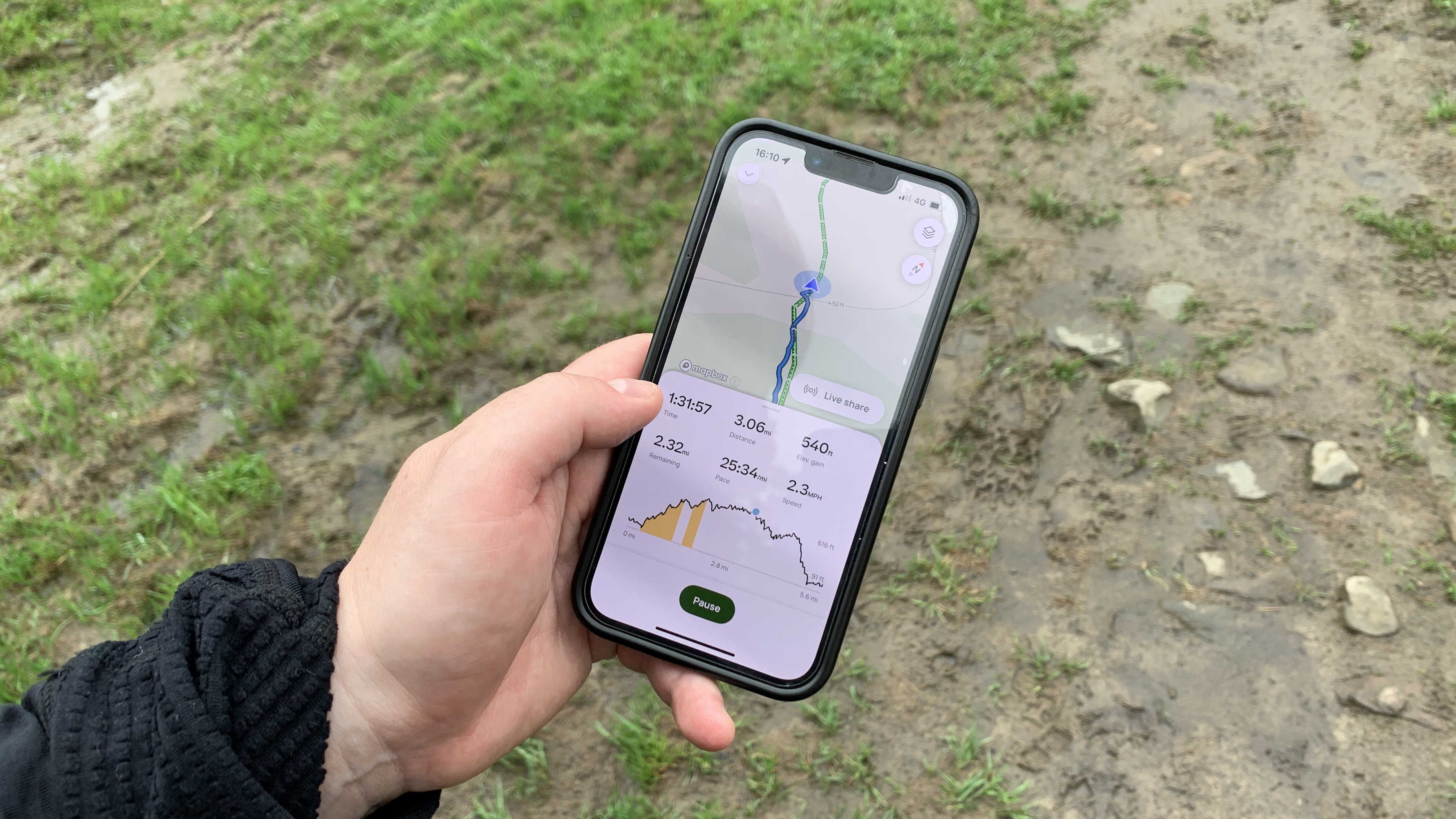
I always thought of AllTrails as a place to find trails, but the app makes it really easy to navigate while on the trail. I first tried this out on a trip to the Lake District with AllTrails where I was shown how to download my chosen route so it would be available offline – this takes seconds and is only available for plus subscribers. That means I could put my phone on flight mode and save battery while still accessing GPS.
At the trailhead, I was able to use the Live Share function to let my emergency contact know where I was at all times (he could also follow my progress and cheer me on, but to be honest we haven't tried this yet, he has better things to do), then I just tapped start and could use the app to guide me during our 10 km hike.
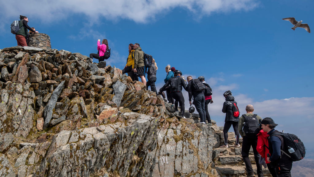
Another function of the paid version is the Wrong Turn Alerts, which are exactly what they sound like. As an experiment on our way up Loughrigg Fell in the Lake District, we deliberately took the wrong turn at a junction and within seconds my phone was letting me know. You can also override this function if you're deliberately going off-piste, which worked to my advantage in Sweden when I wanted to explore more.
I find the screen on my phone is small enough and I don't have any interest in navigating via my GPS watch, but if that's your preference the other journalists on my Lake District trip and some of the folks at AllTrails have explained that the smartwatch integration isn't necessarily the best and it works better on a phone.
Post-trail stats and community
When I finish each hike or run, the stats in terms of distance are always slightly different to my Coros Pace 3 watch readings, but since I only want to use the app for navigation, I'm not too concerned about that and I'm aware that there are always slight differences between GPS devices.
That aside, the app concludes each adventure with the stats you'd expect such as calories, pace, splits and elevation gain, which is a nice bonus especially if you don't use a running watch.
The app also prompts all users, free and paid, to rate their hike and honestly, in a world where we're expected to rate everything, I wasn't sure I'd be into this, but I actually really like it. I love hiking and running and it feels like a really community-minded (and responsible) thing to do to share my experience with others and even warn them if the conditions are tricky.
If you love social media, you can connect with other users and comment on their hikes, just like any social platform, but obviously this has the benefit of allowing you to ask other trail users specific questions which is really helpful.

AllTrails+: the bottom line
As a hiking app, there's not much to quibble with when it comes to AllTrails. It's not got the competitive aspect of apps like Strava, but personally, I appreciate this because hiking isn't a competitive activity (running doesn't have to be either, while we're on the topic). After speaking with representatives from AllTrails, my understanding is that this is a deliberate strategy to differentiate from Strava, which I think is smart.
Do you need to pay extra for the AllTrails+ version? If you want to be able to find out how far trails are from you, download maps for offline access, get real-time trail conditions and better guidance on the trail then I don't think $35.99 a year is a huge amount to ask. It's true that you could download a GPX map and access it on your device and there are other ways to live share your location with family and friends, but I think having all of those features in one place is much more convenient, and puts less strain on your battery.
Finally, you can give the paid version of AllTrails a test run with a free seven-day trial to see if you like it, and if you don't think it's for you you'll still get loads out of the free version.
Julia Clarke is a staff writer for Advnture.com and the author of the book Restorative Yoga for Beginners. She loves to explore mountains on foot, bike, skis and belay and then recover on the the yoga mat. Julia graduated with a degree in journalism in 2004 and spent eight years working as a radio presenter in Kansas City, Vermont, Boston and New York City before discovering the joys of the Rocky Mountains. She then detoured west to Colorado and enjoyed 11 years teaching yoga in Vail before returning to her hometown of Glasgow, Scotland in 2020 to focus on family and writing.
