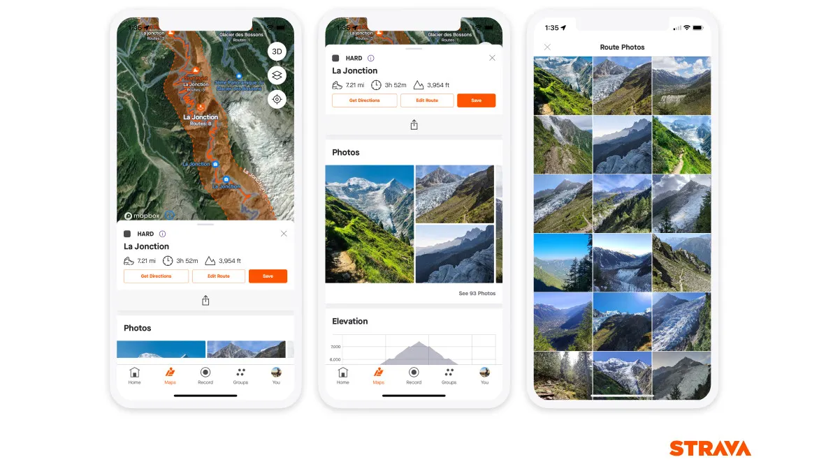
Strava is adding photos to suggested routes to help you understand what to expect before you head out. Starting today (February 20), you will be able to see recent, relevant photos alongside route details so you can check out conditions today, yesterday, over the past week, two weeks, or month.
If you're a Strava subscriber, recent photos will be available when you're browsing route recommendations in the mobile app. The feature will apply to all sport types that support suggested routes (run, trail run, walk, hike, ride, mountain bike ride, and gravel ride
Recent photos should be particularly useful for off-road activities where conditions are highly variable due to weather. Following today's update, you should be able to see whether a suggested route is particularly churned up or flooded, or if a fallen tree has been cleared from a popular trail.
Strava added trail route suggestions in June last year, alongside support for trail running, gravel biking, mountain biking, and e-MTB activities. The suggested trails feature allows subscribers to see popular routes in their area, with different options for different activities.
Recent photos and privacy
Strava is currently sifting through millions of photos saved in the last year, and using a machine learning algorithm to exclude any with identifiable faces or specific gear (including visible branding).
Photos shown in recommended routes won't be linked to profiles or activities, and there will be no identifiable information attached.
No photos will be taken from activities or profiles with privacy restrictions (whether set to 'followers only' or 'only me') and you can opt out by changing your privacy settings to ensure your snaps are excluded.
Off-road sports have boomed in recent years, and Strava's 2022 fitness report showed that the number of hikes recorded using the app doubled over the last two years. There are more changes on the way for those with a penchant for mud, too. Last month Strava bought 3D mapping company Fatmap, and plans to integrate its tech into its services in the future along with specially curated local guides, points of interest, and safety information.
- Best navigation apps: the best free and premium apps for explorers