Garmin promises high-tech tracking and immersive maps with all-new GPS range
Three new Garmin Montana navigators boast detailed topographic maps and handy GPS tracking

Garmin lovers can now hit the trails with a new piece of GPS kit as the sports tech specialist has just launched its latest range of handheld navigators.
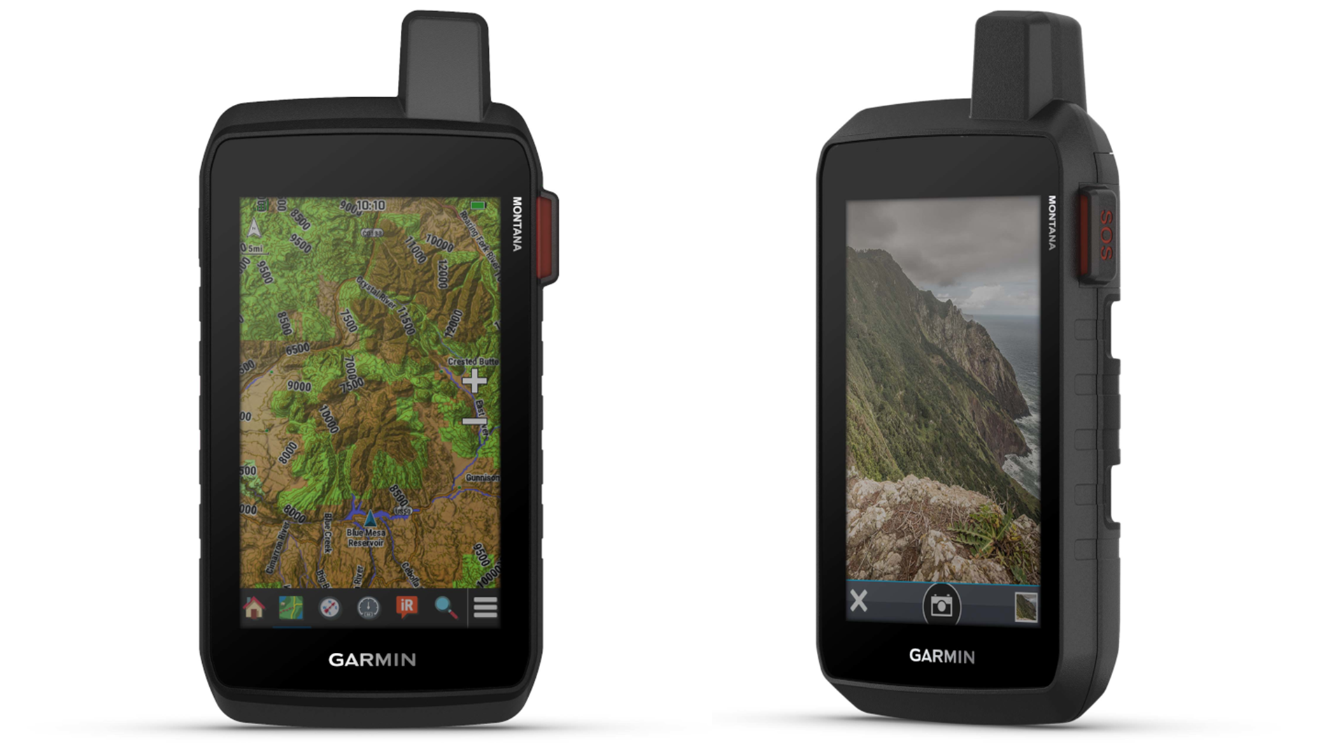
Combining Garmin’s popular GPS tech with immersive maps and several new navigation features, the new Montana navigators - named for the Big Sky state in the US - come in three different models.
Featuring a five-inch, glove-compatible color touchscreen, the Montana 710, 710i, and 760i satellite communicators are designed for rough use during backcountry activities like hiking, trail running, and mountain biking. They’re thermal, shock, and vibration resistant and claim an IPX7 rating for water resistance, which should allowing them to continue functioning at up to a meter of depth for 30 minutes.
All three use Garmin’s TopoActive mapping technology, which provides detailed visualizations of rugged terrain, coastlines, and summits. Alternatively, you can plot routes with downloadable satellite image maps, which Garmin claims are ‘high resolution’ and ‘photorealistic’.
Alongside tracking your journey, the Montana range aims to provide valuable insight into your progress with its navigation sensors. Among others, the built-in altimeter provides relevant data on your elevation, while a barometer measures the weather and a three-axis electronic compass keeps you on course.
All three models are powered by a rechargeable lithium-ion battery, which provides 24 hours of life in GPS mode and 440 hours in expedition mode.

Suitable for remote backcountry adventures, the 710i and 760i models feature Garmin’s InReach satellite technology. Not reliant on phone signals, InReach tech can be used to communicate from all manner of remote locations, helping hikers call for help in extreme circumstances.
Advnture Newsletter
All the latest inspiration, tips and guides to help you plan your next Advnture!
Life-saving on several occasions, Garmin InReach devices have been used to call for emergency help more than 10,000 times since 2012. In October, a hiker stranded on a Colorado mountain was rescued after calling for help using his InReach device. Only the previous month a Canadian hiker who’d been mauled by a bear was rescued thanks to his InReach device.
Despite its life-saving capabilities, InReach tech can be costly, requiring a monthly satellite subscription priced between $11.95 / £14.99 and $79.95 / £49.99 depending on your chosen features, as well as the initial upfront cost of the device itself.
Top of the Montana range, the 760i model also includes an 8-megapixel camera which automatically geotags images so you can return to your favorite spots later.
“No matter your adventure, the new Montana series can guide you and keep you connected, even when exploring off the grid,” claims Dan Bartel, Garmin’s Vice President of Global Consumer Sales.
Now available on the Garmin website, the Montana 710 has a list price of $649.99 / £549.99. Its satellite-capable alternative, the 710i, costs $799.99 / £729.99.
With both InReach tech and a geotagging camera, the top-of-the-range 760i costs $899.99 / £799.99.
- The best Garmin watches 2025 make the right choice for the sport you love
- The best GPS watches 2025 feature-packed time pieces to keep you on course

Will Symons developed his love of the outdoors as a student, exploring every inch of Sussex’s South Downs national park and wild swimming off the Brighton seafront. Now a Staff Writer for Advnture, Will previously worked as a freelance journalist and writer, covering everything from cricket to ancient history. Like most Advnture staff, Will’s time is rarely spent indoors, he can often be found hiking, wild swimming or playing cricket.
