How to navigate without a compass: survival skills 101
Learning how to navigate without a compass could save your skin when your go-to navigation tool goes AWOL

Knowing how to navigate without a compass is one of those survival skills that you don’t really need to know until you really, really need to know…by which point, you’re usually up the proverbial creek of poop without a paddle in sight.
While we’d always recommend learning how to read a map and how to use a compass (and carrying a spare just in case), accidents do happen – compasses get dropped and broken, maps get tossed over cliffs by sudden gusts of wind, and GPS devices – like all electronics – can suffer mechanical failure, battery death, or just plain stop working at the most inappropriate moment.
In any of the above scenarios, would you be able to find your way to safety?
In this post on how to navigate without a compass, we’ll show you how it’s done.
How to navigate without a compass using the sun
The sun is, luckily, one of the most reliable features in our universe and fairly set in its way as regards its daily habits. For this reason, it has been used by wayfarers, sea voyagers, all other kinds of travelers and explorers for millennia to get from their A’s to their B’s.
As we all know, the sun rises in the east and sets in the west. In the Northern Hemisphere, the sun’s highest point in any given day is also due South. With this info, by simply observing where the sun is in the sky we can get a ballpark bearing for each of the four cardinal directions.
How to navigate without a compass using your map
If visibility is decent and you’re hiking in relatively featured terrain, navigating with a map alone is easily done. All you have to do is identify one or two obvious features in the terrain, find these on your map, and then use the feature to orient your map. Doing this, you can also use the grid lines or compass rose on your map to get a bearing on the four cardinal directions.
Advnture Newsletter
All the latest inspiration, tips and guides to help you plan your next Advnture!

How to navigate without a compass by creating your own sundial
On sunny days, one of the simplest ways to get a bearing on north is by creating your own sundial using a stick, a pair of stones, and a little bit of patience. Here's how it's done:
- Start by sourcing a relative straight stick that measures 2-3 feet in length
- Poke the stick deep enough into the ground that it’s freestanding (i.e. you don’t need to hold it in place and the wind won’t blow it over) on a clear, level patch of ground
- Use your first stone to mark where the tip of the shadow cast by your stick lands
- Wait 30 minutes
- Place a second stone at the new point where the shadow cast by your stick now lands (the shadow should have moved and lengthened or shortened)
- Draw a line between the two stones – this line will give you an east-west axis, with the first stone representing west and the second representing east
- Stand facing your east-west axis with the sun behind you and your first stone on your left. The direction you are facing is north.
How to navigate without a compass by using the stars

Like the sun, the stars are altogether reliable indicators of direction. All you need to use them to navigate is a clear night, decent eyesight, and the ability to identify groups of stars.
If you’re in the Northern Hemisphere, the night sky’s most useful navigational aid is a sizable shiner by the name of Polaris, aka the North Star. As the name suggests, this provides navigators with a bearing on the most popular of the four cardinal points: north.
If you’re unfamiliar with the constellations and their occupants, locating the North Star requires identifying the Big Dipper, which is composed of an octuplet of stars that, were you to join the dots between them, would form a shape not altogether dissimilar to a huge pan with a crooked handle (pictured above). By following an imaginary line that extends upwards from the Big Dipper’s two outermost stars, you’ll eventually come upon the North Star.
If you’re in the southern hemisphere, the go-to collection of stars for nighttime navigation are a quadruplet called the Southern Cross (pictured below), which – as the name suggests – is a huge, easily identifiable, cross-like configuration in the southern portion of the night sky. Once you’ve located this, draw an imaginary line from the top of the cross to the bottom, and then continue south by roughly five times the cross’s height. The base of this imaginary line gives you a ballpark bearing on south that can then be used to establish the other cardinal directions.

How to navigate without a compass using water features
In navigation-speak, water features are known as “handrails” because they can be used, like the rails on a staircase, to guide you along or close to your desired direction of travel.
If, for instance, you know where a stream, river, or lake lies in relation to other features in the area, then you can use them as a reference for getting to where you need to go, or simply follow them as far as is needed before diverting course in the direction of your destination or next trig point.
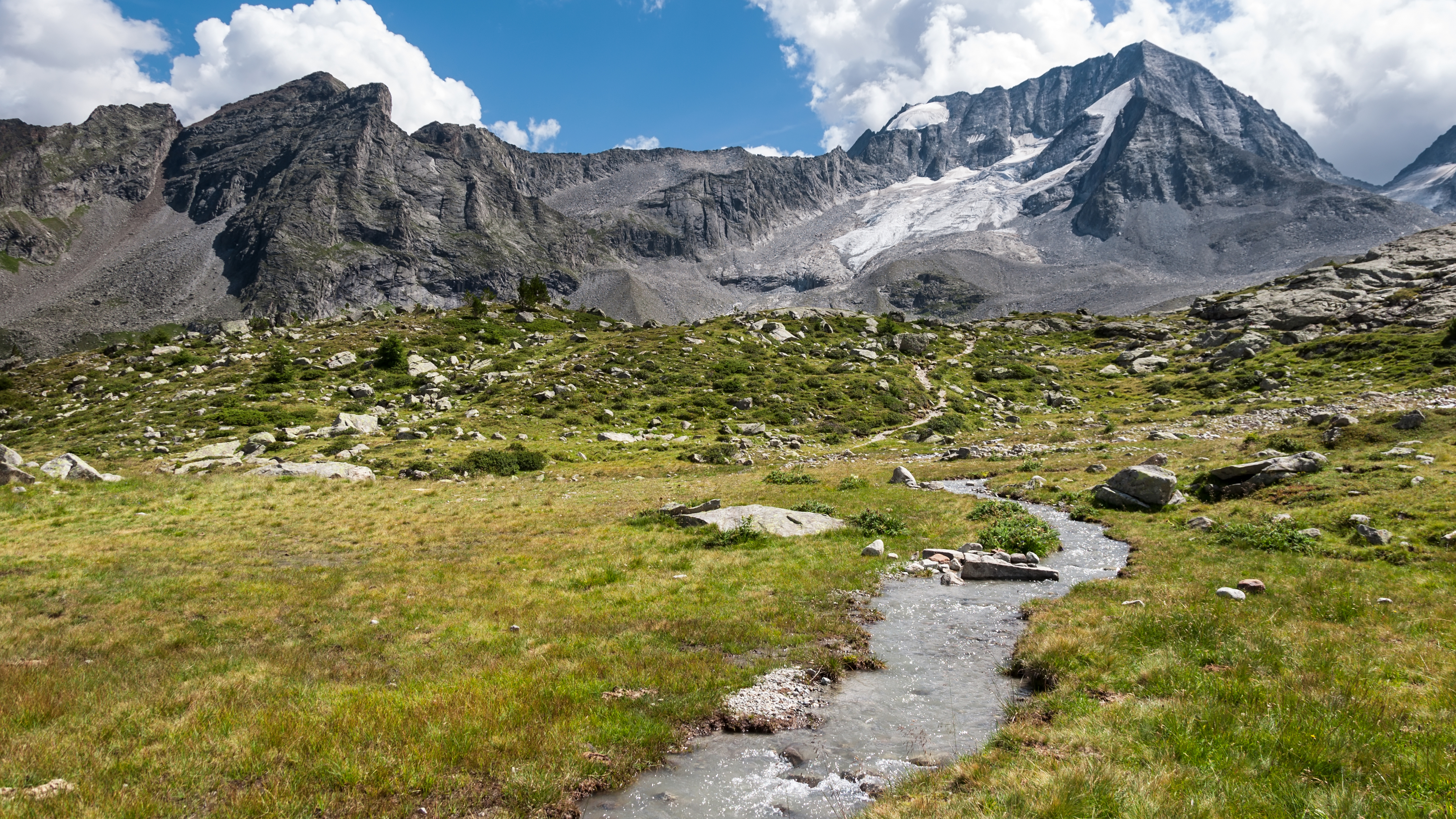
Streams on mountainsides are also handy navigational aids, especially when you’re navigating in poor visibility. Because all water flows downhill to meet other, larger water sources, you can use minor streams to reach larger, (hopefully) easily recognizable water features in the area.

How to navigate without a compass with an analog watch
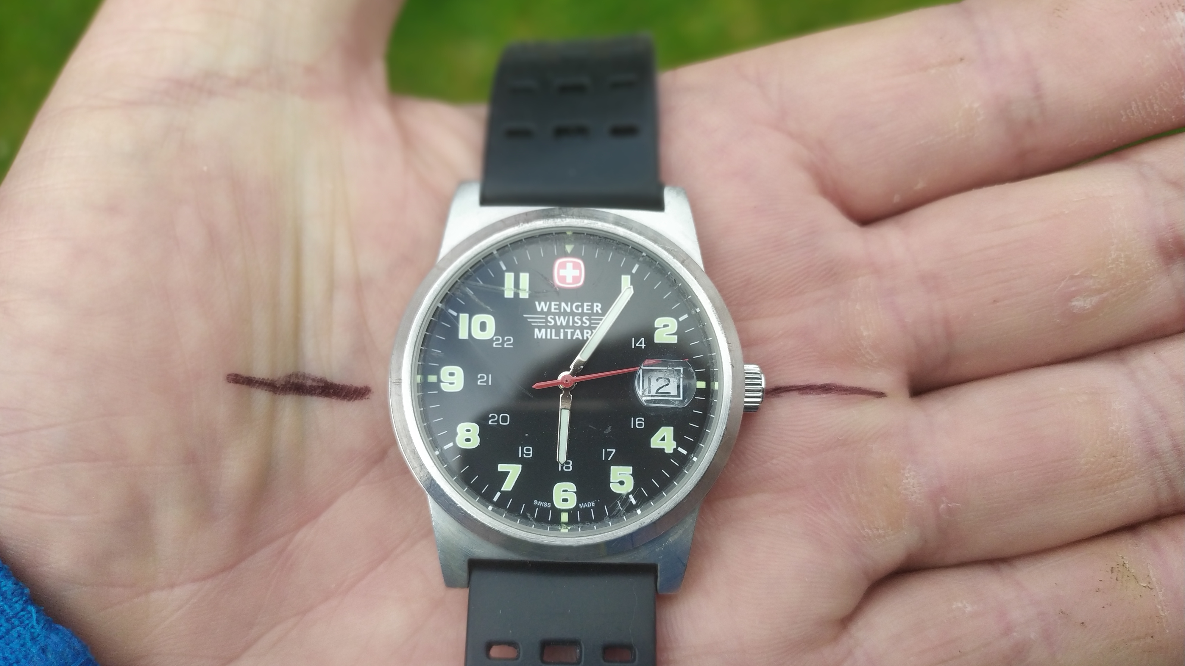
If you don’t happen to have one of the best GPS watches on your wrist, but an old-school analog variant, you may still be able to use your timepiece for navigation.
The disparity between solar time and standard time means that this isn’t the most accurate way to navigate without a compass, but it can help you find a more general bearing if you’re in a bind and none of the other options mentioned above are feasible.
To use your analog watch:
- Wind your watch back an hour if it is set to daylight savings time
- Take the watch off and hold it out in front of you in the palm of your hand, making sure it’s level with the ground
- Point the long, hour hand towards the sun
- Using a pen or pencil, sketch a line outward from the midway point between the hour hand and 12 o’clock and from the exact opposite side of the watch. If, for example, it’s 6 o’clock, then this line should extend from 3 on one side of the watch and 9 on the other side
- Joining the line gives you a north-south line, with north represented (in the Northern Hemisphere) by the side pointing away from the sun

How to navigate without a compass using moss
This is probably the least reliable method of compass-free navigation, primarily because several other variables can come into play and give you a false reading. If you have no other means at your disposal and take your readings with a pinch of salt, however, learning how to navigate without a compass by using moss might prove useful in a bind.
Moss usually grows on the side of trees and rocks that spend most of the day in the shade. If you’re in the northern hemisphere, then, this means that moss is prone to growing on the northern side of natural features, and on the southern side in the southern hemisphere.
However, it’s important to bear in mind that several other factors can cause moss to grow in any given location, most importantly humidity (from streams or standing water) and shade provided by other nearby features.

- The best compass 2024: find your way with the finest standard navigational tools
- 7 reasons you need a survival shelter: the ultimate safety net
Former Advnture editor Kieran is a climber, mountaineer, and author who divides his time between the Italian Alps, the US, and his native Scotland.
He has climbed a handful of 6000ers in the Himalayas, 4000ers in the Alps, 14ers in the US, and loves nothing more than a good long-distance wander in the wilderness. He climbs when he should be writing, writes when he should be sleeping, has fun always.
Kieran is the author of 'Climbing the Walls', an exploration of the mental health benefits of climbing, mountaineering, and the great outdoors.

