8 great South West Coast Path walks: from the highest point on England’s South Coast to the country’s most southerly point
Our selection of wonderful South West Coast walks – along sections of Britain’s longest national trail – takes in everything from beautiful beaches to high hilltops, via gorgeous coves and dramatic moorland
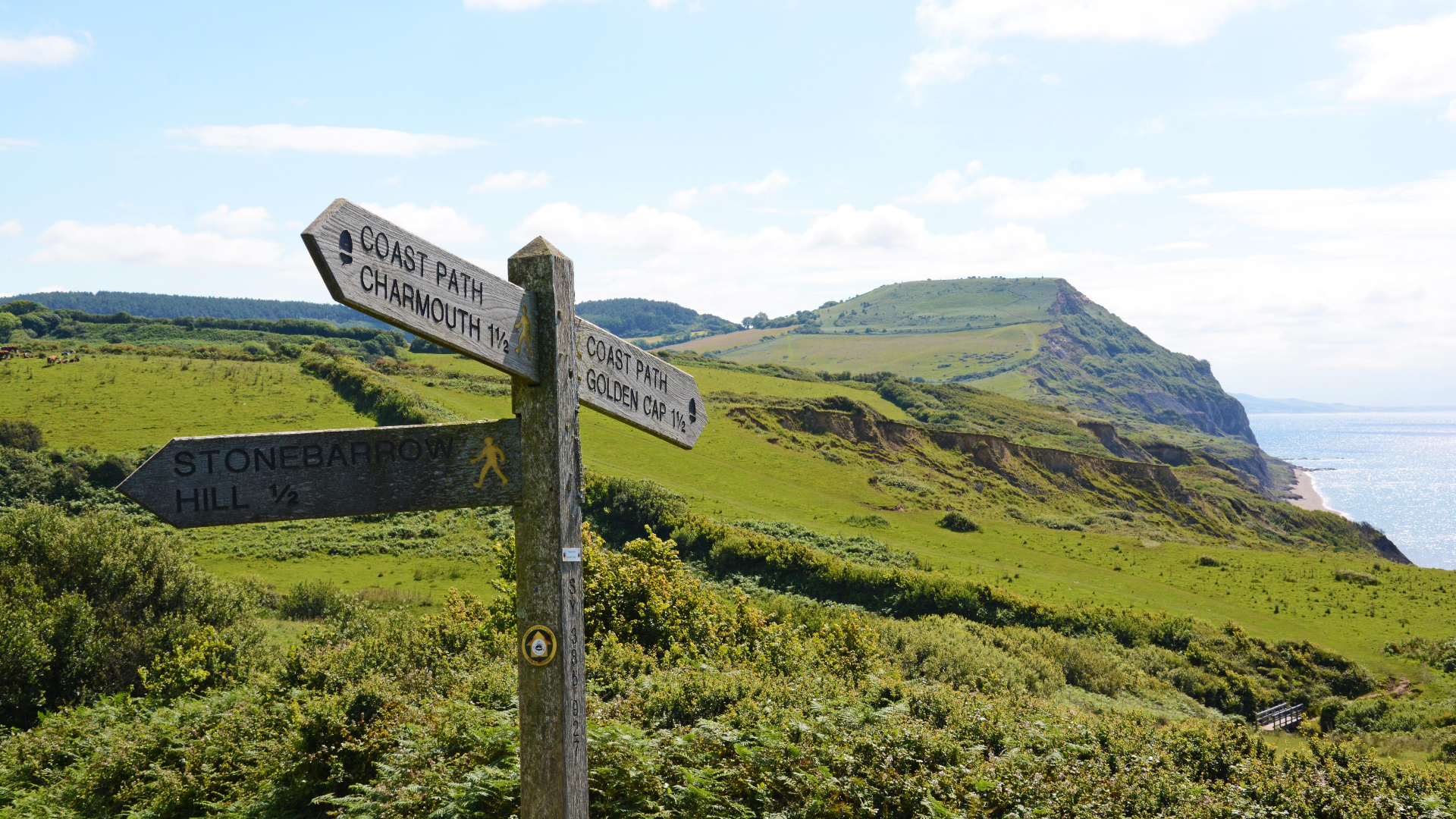
Stretching 630 miles, from Poole in Dorset to Minehead in Somerset, the South West Coast Path (SWCP) is an epic trail by anyone’s standards. It traverses some of the most stunning landscape in the country, running along the cusp of a national park in Exmoor and tracing the edge of World Heritage Listed areas on the colourful cliffs and fossil-strewn beaches of the Jurassic Coast and around Cape Cornwall, where the chimneys of old tin mines punctuate the skyline.
But just because it’s beautiful, that doesn’t mean it is gentle. Clinging close to the coastline of the four counties that comprise England’s southwest peninsular – Dorset, Devon, Cornwall and Somerset – the path takes a rollercoaster route, rearing up and over imposing peaks such as Golden Cap and Hangman Hill, and then plunging right down to sea level.
Intrepid hikers who tackle its entirely will do 35,000 metres (115,000ft) of ascent and decent between the two trailheads, which is the equivalent of walking up and down Mount Everest four times. It has been run as quickly as 10 days, 12 hours and 6 minutes, but most thru-hikers (what is thru-hiking?) take at least six weeks to walk the trail.
But you don’t have to walk the whole thing, of course. There are myriad magical short walks along sections of the path that give you a delicious taste of the trail, while still letting you return to the pub in time for dinner. Following is a selection of our favourite day hikes that take in a slice of the South West Coast Path.
All except the Halzephron to Kynance Cove walk are return routes, and we have typically supplied looping options, but often the best way to get back to your starting point on the South West Coast Path is to return back along the path itself, which invariably supplies surprising new views when you walk the same stretch in a different direction.
- Plan on hiking the South West Path? If so, be sure to kit yourself out with the best hiking boots or best hiking shoes
- And because Old Blighty's weather is ever-prone to misbehaviour, be sure to pack one of the best waterproof jackets for men or best women's waterproof jackets to keep you dry
- In our experience, most of the views on these routes are best enjoyed with a can or bottle of something cool and bubbly. For safekeeping of your precious mid-walk refreshments - and all the rest of your kit - we recommend our best hiking backpacks and best daypacks
Advnture’s 8 best South West Coast Path walks
1. BACKDOOR TO DURDLE – DORSET
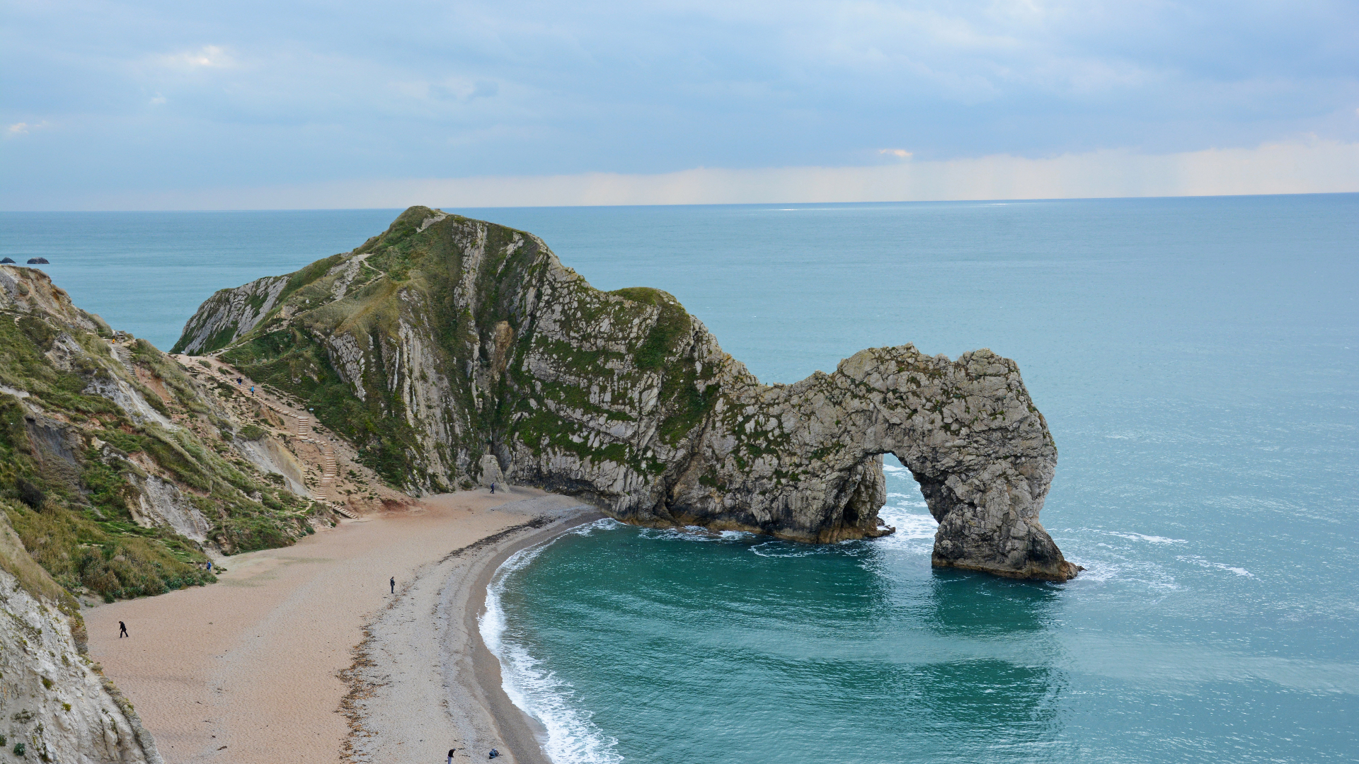
Avoid the crowds and walk a wonderful back route to Durdle Door, to score an eyeful of one of the most iconic views on the South West Coast Path
- Distance: 13km (8 miles)
- Ascent/Descent: 330m (1075ft)
- Start/finish: Ringstead National Trust Car Park
Durdle Door, a lovely limestone arch that steps elegantly out into the swirling sea on Dorset’s Jurassic Coast World Heritage Site, halfway between Swanage and Portland, is one of the most gawped at and photographed spots on the entire British coast. But its popularity means the approach path can be packed and car parking is often at a premium. This walk gives you all the vistas and plenty of wows, minus the crowds.
Advnture Newsletter
All the latest inspiration, tips and guides to help you plan your next Advnture!
From Ringstead National Trust Car Park (cheap/free for members) stroll south, along laneways, to meet the sea at the remains of Ringstead Radar Station, once an important part of Britain’s defence system. Bear left along the South West Coast Path (SWCP) and walk with the waves rolling in to meet Ringstead Beach on your right, below Burning Cliff. Shortly you’ll pass St Catherine-by-the-Sea, a wooden church with a wicked view.
Keep following the SWCP past White Nothe (where an old smugglers’ path that features in J Meade Falkner’s classic novel Moonfleet sneaks down to the beach), drinking in the views all the way. Notable landmarks include Bat’s Hole, another sea-sculpted natural arch in the chalk cliff face, much smaller and less famous than its limestone neighbour.
At Bat’s Head, a chalky platform that juts into the sea, stop and take in the stunning sight of Durdle Door, which is sensational from this well-earned perspective. This is the spot to get that killer photograph, with a bovine-themed family of sea stacks (the Calf, the Cow and the Bull) in the foreground.
If you want to avoid the crowds altogether you could turn around here, but we recommend carrying on to explore Durdle Door up close, descending to the beautiful beaches on either side of the arch, and even going for a wild swim through the door itself. On the far side, the Man ’o War rock formations and beach are well worth a look.
When you’ve had enough, make your way back, either retracing your steps along the South West Coast Path (which is always rewarding when walked in different directions) or turning right to wander through wonderfully named Scratchy Bottom before forking left to follow the slightly more inland route indicated.
2. GOLDEN CAP – DORSET
Climb the highest peak on Britain’s south coast and earn some breathtaking views along the World Heritage–listed Jurassic Coast and across the green hills of Dorset and Devon
- Distance: 7.5km (4.5 miles)
- Ascent/Descent: 236m (775ft)
- Start/finish: Stonebarrow National Trust Car Park
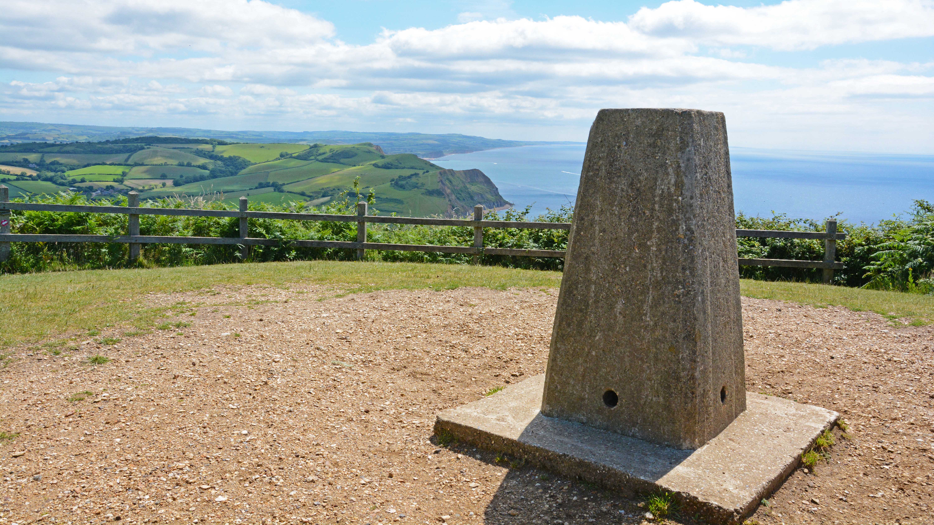
The tallest point on the Jurassic Coast the beautiful blonde bonce of Golden Cap – coloured by the ammonite-addled rock that defines this World Heritage–listed length of seascape – is instantly recognisable as soon as you arrive at the start point of this walk.
From the western end of the National Trust car park at Stonebarrow (cheap / free for members), follow the path leading southwest, towards the sea. Ignore the ‘Smuggler’s Path’, which forks right, to Charmouth, and continue straight through Westhay Farm. At the junction with the South West Coast Path (SWCP), turn left and walk towards Golden Cap, the distinctive flat-topped hill dominating the skyline.
Trace this trail (also a section of the Monarch’s Way) as it skirts the cliffs above famously fossil-strewn Charmouth Beach, meandering through meadows, alive with butterflies in spring and summer. At a stream (Westhay Water) the path dips to cross a footbridge. Some maps indicate an access route to the beach here, but it’s long gone.
Continue and cross a second stream (Ridge Water), and then a third, near St Gabriel’s Steps (which have been lost to erosion), before climbing the zigzag trail scarred into the side of Golden Cap. It’s a stiff, steep ascent to the top, but views easily justify effort. From here you can peer right around Lyme Bay – to Portland on one side and Lyme Regis on the other – and look inland across the chimney tops and thatch-headed houses of umpteen villages to Thomas Hardy’s literary hunting ground.
Continue over the peak of the Cap, passing a memorial stone dedicated to Randal John Somerled McDonnell, 8th Earl of Antrim and Chairman of the National Trust, which maintains this whole section of coast. Pause at the trig point marking the 191-metre summit, to check out the vista across Seatown to Thorncombe Beacon and the isthmus of Portland jutting out into the sea beyond. When you’ve had your fill of the view, descend via a path on the hill’s northeast.
Pass through a gate, ignoring paths leading right (towards Seatown) and straight (to Langdon Hill), and instead turn left and hug the top of the field. You’ll reach another gate on your left; go through this and follow fingerposts pointing to St Gabriel’s, an 800-year-old chapel that served the lost hamlet of Stanton St Gabriel until local smugglers repurposed it.
Pass through the remains of the vanished village, now just a farmhouse, holiday cottage and information boards, and follow signposts towards Stonebarrow. Take care to pick the right route when leaving the village, as alternative footpaths lead left to St Gabriel’s Mouth, and right towards Morecombelake.
Our route follows a bridleway and lane before turning left, crossing a stile and going along a footpath to dogleg through Upcot. It then arcs across Chardown Hill to arrive at the eastern end of Stonebarrow Lane car park, where there’s an old radar station, and your car awaits.
3. VALLEY OF THE ROCKS – NORTH DEVON
Explore an enigmatic dry valley on the edge of Exmoor, home to wild goats and tall stories
- Distance: 6.5km (4 miles)
- Ascent/Descent: 198m (650ft)
- Start/finish: Exmoor NP Car Park, at the eastern entrance to the Valley of the Rocks
There’s a lost world feel to the Valley of the Rocks, a rugged ravine left high and dry many millennia ago when the River Lyn suddenly changed direction. An evocative and occasionally eerie place, inhabited by wild goats, the vale has inspired writers including Samuel Taylor Coleridge and William Wordsworth, and its craggy architecture echoes with ancient legends.
From the car park, walk across the road and follow the footpath directly ahead, which ascends the western cheek of Hollerday Hill. The path elbows right and meets a T-junction; turn left and stroll along a sealed section of the South West Coast Path, with the serrated profile of the rocks on one side and sea to your right.
Soon you’ll pass beneath Rugged Jack, a tumbling tor towering over a spellbinding vista of the Exmoor Coast as it runs along the Bristol Channel towards the Celtic Sea. One Sunday, druids were caught dancing on this vantage point by the Devil, so the story goes, and he turned them to stone. Undeterred, a mischievous mob of feral fellows still prance around here: the resident goats, who put local climbers to shame with their crag-clinging skills and have been enjoying the run of the rocks since at least the 11th Century, when the Domesday Book noted their presence.
As the path rounds the head and descends, clamber up the rough trail on the right to explore iconic Castle Rock, which offers a regal view across Wringcliff Bay. While descending, look back to see the profile of the ‘White Lady’ formed by cracks in the stone. On the opposite side of the valley, another rock formation, known as the Devil’s Cheese Ring, was used by author RD Blackmore as the home of a witch, Mother Meldrum, in his novel Lorna Doone.
At the roundabout, a return trail leads down to the shingle-and-sand beach of Wringcliff Bay, a beautiful secluded cove that you can often have all to yourself.
Back on the road, descend towards Lee Abbey. Take the track that branches left opposite this Gothic mansion and climb the hill. As you approach Six Acre Wood, take a sharp left to follow the bridleway along a gentle tree-fringed incline. When you reach a switchback, leave the bridleway and go straight ahead along trail that zig-zags through heather to join a path leading east above South Cleave, a protected part of the valley that boasts evidence of a Bronze Age huts and prehistoric Celtic field systems. Stay on this trail as it wends right and then descends towards the car park where you started, passing a cemetery on the right.
4. BOLT HEAD – SOUTH DEVON
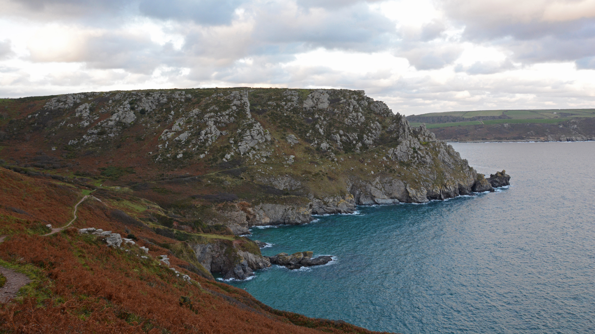
A cliff-top bay-to-bay hike across dramatic headlands just outside Salcombe, via a surprise walker-friendly tearoom and a mysterious mansion
- Distance: 8.5km (5.3 miles)
- Ascent/Descent: 175m (575ft)
- Start/finish: East Soar National Trust Car Park
Salcombe, in Devon’s sensational South Hams, is one of the county’s most popular holiday spots, but this walk takes you well away from the crowds to secret beaches and beautiful bays, accessible only by foot and haunted by shipwrecks.
From the car park, ignore the track going down to East Soar Farm, and instead walk south, along the lane. After about 100 metres, take the footpath going right and stroll across farm fields towards the sea, passing buildings at Middle Soar. Continue to a T-junction just above The Warren, turn left and follow the trail until it meets the South West Coast Path.
Follow the South West Coast Path as it wends through dramatic wind-sculpted rocks and rounds beautiful Bolt Head. Look out for peregrine falcons, kestrels, cirl buntings and rare Dartford warblers here, and enjoy the stunning views across the Mew Stone rock formations and over the restless waves – which cover a multitude of wrecks, including HMS Ramillie, which went down in 1760 in a tragedy so terrible that local folk songs still lament the loss of over 700 lives.
The path skirts Starehole Bay, location of a secret beach and the submerged skeleton of another wreck, the Herzogin Cecilie, which came to grief on the rocks here in 1937. When the track splits at Starehole Bottom, take the lower option (right) and pass beneath Sharp Tor. Before you is Kingsbridge Estuary, busy with little fishing boats, yachts, kayaks, ribs and ferries full of tourists. Keep following the coastal path, past the delightfully named Stink Cove and Splatcove Point, towards South Sands, where you can grab a coffee or hire a kayak at Bo’s Beach Café.
Retrace your steps back up the hill, but then veer right and walk past the National Trust property of Overbeck's – former home of eccentric scientist Otto Overbeck, a pioneer of electrotherapy and inventor of the dubious sounding ‘Rejuvenator’, who also cultivated the still-thriving tropical plants in the gardens. Go around the property, take the first left to cut across Fir Woods, and continue to the top of Sharp Tor to enjoy magnificent views across to Prawle Point – Devon's most southerly piece of terra firma.
Take the footpath around the cliffs, then follow a fingerpost sign pointing towards the East Soar Outdoor Experience, where you can visit the wonderful Walkers' Hut. Hot and cold drinks are available here, along with homemade cakes and other treats, either served by a friendly South African couple, or left out for you to help yourself, with an honesty box provided for payment. A small playground and a hobby farm keeps kids happy. When you’re done, wander on through the farm and follow the track all the way back to the car park, passing a small air strip on your right.
5. MORTEHOE – NORTH DEVON
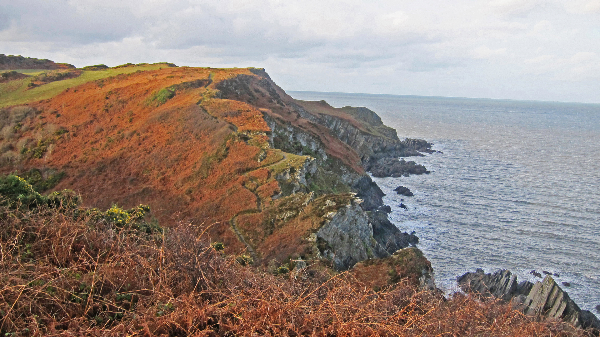
A wild wander around Morte and Bull points on Devon's surf-stroked north coast, featuring secret coves, sensational seascapes, magical marine life and ancient woodlands
- Distance: 7.25km (4.5 miles)
- Ascent/Descent: 160m (525ft)
- Start/finish: Mortehoe village car park
This magnificent meander across clifftops and through colourful coastal heathland traces a double-bladed dagger of land, which stabs into the Bristol Channel between the seaside resorts of Woolacombe and Ilfracombe. This headland was once the haunt of smugglers, attracted by its hidden beaches and secret sandy bays, the same features that now draw and awe walkers and wilderness lovers, who come to explore the curvaceous cliffs and winding footpaths, which always offer the possibility of dolphin and seal sightings. The area's macabre moniker ('morte' means 'death' in Latin) is a reminder that the treacherous rocks around this section of the North Devon coastline sent many ships to their doom.
From the car park, walk down the hill, passing a church and the Chichester Arms. After about 100 metres, take the gate on your right onto a National Trust footpath and continue towards Grunta Beach – the northern extremity of Woolacombe Sands. When you meet the South West Coast Path (SWCP), turn right and follow the path as it skirts the water's edge around Windy Cove and reaches the end of the peninsular at magnificent Morte Point, where you can enjoy views to Lundy Island and across the Bristol Channel to Wales.
At Whiting and Oreweed coves, look out for seals, which commonly cavort around this protected pocket of Rockham Bay. Keep strolling, around a collection of coves, to Rockham Beach, where there a tidal pools aplenty to explore. A set of steps marks the start of an undulating section with some stern climbs and stunning views. At Bull Point the lighthouse winks at Wales across the channel. From here, make your way along lanes via North Morte Farm, back into Mortehoe, for a pint in the charismatic Ship Aground pub.
6. SELWORTHY BEACON AND NORTH HILL – SOMERSET
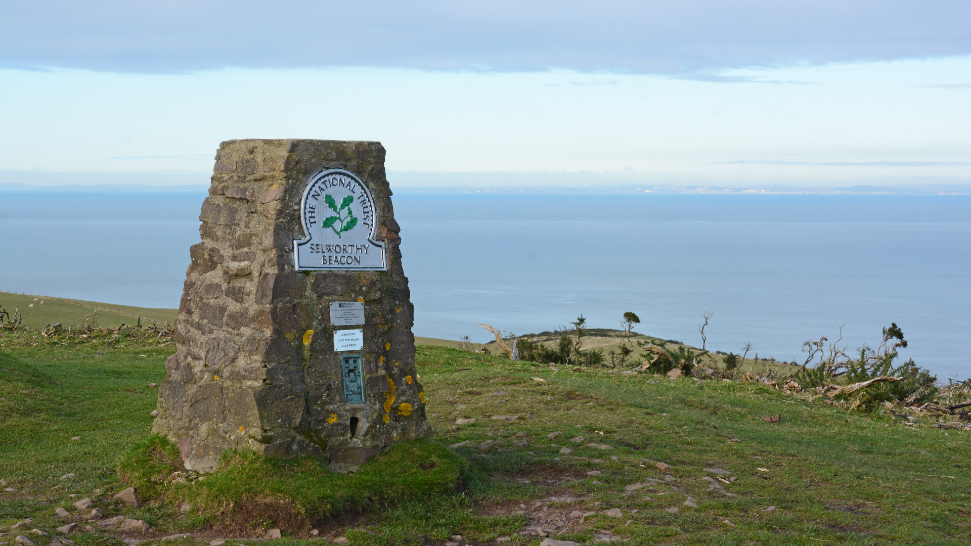
This rewarding ramble follows a rollercoaster route along a sensational section of the South West Coast Path, offering stunning sea views every step of the way
- Distance: 12.5km (7.75miles)
- Ascent/Descent: 183m (600ft)
- Start/finish: Selworthy Beacon viewpoint car park, at the far end of Hill Road (accessed via Minehead).
During this walk across the colour-splattered heather-covered cliffs that trace Somerset’s curvy coastline, look out for wild Exmoor ponies, glance skyward to see buzzards, peregrine falcons and kestrels wheeling above, and scan the sea for porpoises, dolphins and other marine life.
After checking out the vista from the viewpoint at the eastern end of the car park, looking out over Porlock Bay, turn right and walk north towards the sea, along the level track (not the descending path). Keep going straight head at the first junction, and stay left when you meet the South West Coast Path. Just 30 metres later there’s another junction – go straight ahead, towards the rounded hillock of Bossington Hill, keeping to the gently descending path (not the bridleway that drops steeply left). Bossington Hill cairn is off to your left, along with spectacular coastal views.
When you reach a fingerpost pointing towards ‘Bossington’ (left), ignore that and go straight ahead, following the sign indicating ‘Rugged Coast Path’ and keeping to the main track as it arcs right. You’re now walking east along the South West Coast Path (SWCP), with white-capped waves and views of Wales left, and Minehead straight ahead. The path writhes serpentine-like around the combes that indent the coast here, like bitemarks in Exmoor’s sea-facing flank. When the path forks again, by a ‘Rugged Coast Path’ sign, stay left once more, sticking close to the coast and descending around the head of East Combe.
The path ventures deep into Henners Combe, taking you temporarily away from sea and along a rolling route, dropping to cross the stream that’s been carving the combe for millennia, and then clambering back out the other side. Continue walking east along the cliff-hugging South West Coast Path, with the sea on your left. The trail becomes quite narrow at times, with steep drops directly onto the rocks, so be careful.
Round Furzebury Break (topped by an Iron-Age hillfort, sadly inaccessible) and descend into Grexy Combe. Cross the stream and climb back up the other side, along a steep zigzag path to a broad grassy area – a great picnic spot on calm days. Go through a gate onto North Hill, which was used for tank training during WWII by Canadian and American troops, and remains pockmarked with scars from their bunkers, observation posts and gun platforms. Walk up the broad, grassy track towards the summit until a path comes in from the left, by a wooden seat with great views east towards Brean Down and the Holm islands.
Go right here, walking away from the sea. When you reach a T-junction and fingerpost indicating the ‘Coast Path’, turn right and walk back along the inland iteration of the South West Coast Path, which tiptoes through sections of the National Trust’s Holnicot Estate. Walk via the trig point at Selworthy Beacon, part of a chain of beacons lit to raise the alarm as the Spanish Armada approached the English coast in 1588. Turn left and descend to the road. Cross, then pick up the footpath that leads right, past the ‘Welcome Hut’ and back through the trees to the car park.
7. HALZEPHRON CLIFFS TO KYNANCE COVE, THE LIZARD – CORNWALL
From the cliffs of hell to a heavenly cove, via the ‘Church of the Storms’, sensational surf beaches, bays with resident seals and a historic telegraph station – this is one dramatic dawdle to wire home about
- Distance (one way): 15km (9.25 miles)
- Ascent/Descent (one way): 282m (925ft)
- Start: The Halzephron Inn car park
- Finish: Kynance Cove
Halzephron means ‘Hells Cliff’ in Old Cornish, and this coastline is renowned for wild storms, shipwrecks and smuggling. We start at a 500-year-old salt-encrusted pub, steeped in history and bootlegging yarns. Built in 1468, the Halzephron Inn is decorated with wood retrieved from local wrecks and its thick walls conceal tunnels to ancient hidey holes where contraband was once stashed. It also has great beer, but first you need to earn a thirst.
Take the lane opposite the pub to the sea. Turn left along the South West Coast Path (SWCP) and skirt the cove until you reach the sign announcing Halzephron Cliffs. Keep going, around Pedngwinian Point, and be sure to peer into the cove below to see if any seals are around.
Continue, taking in the views of Porthleven in one direction and The Lizard’s tail in the other, until you get to Church Cove. Here, nestled into the nape of the headland, is evocative St Winwaloe, ‘The church of the Storms’.
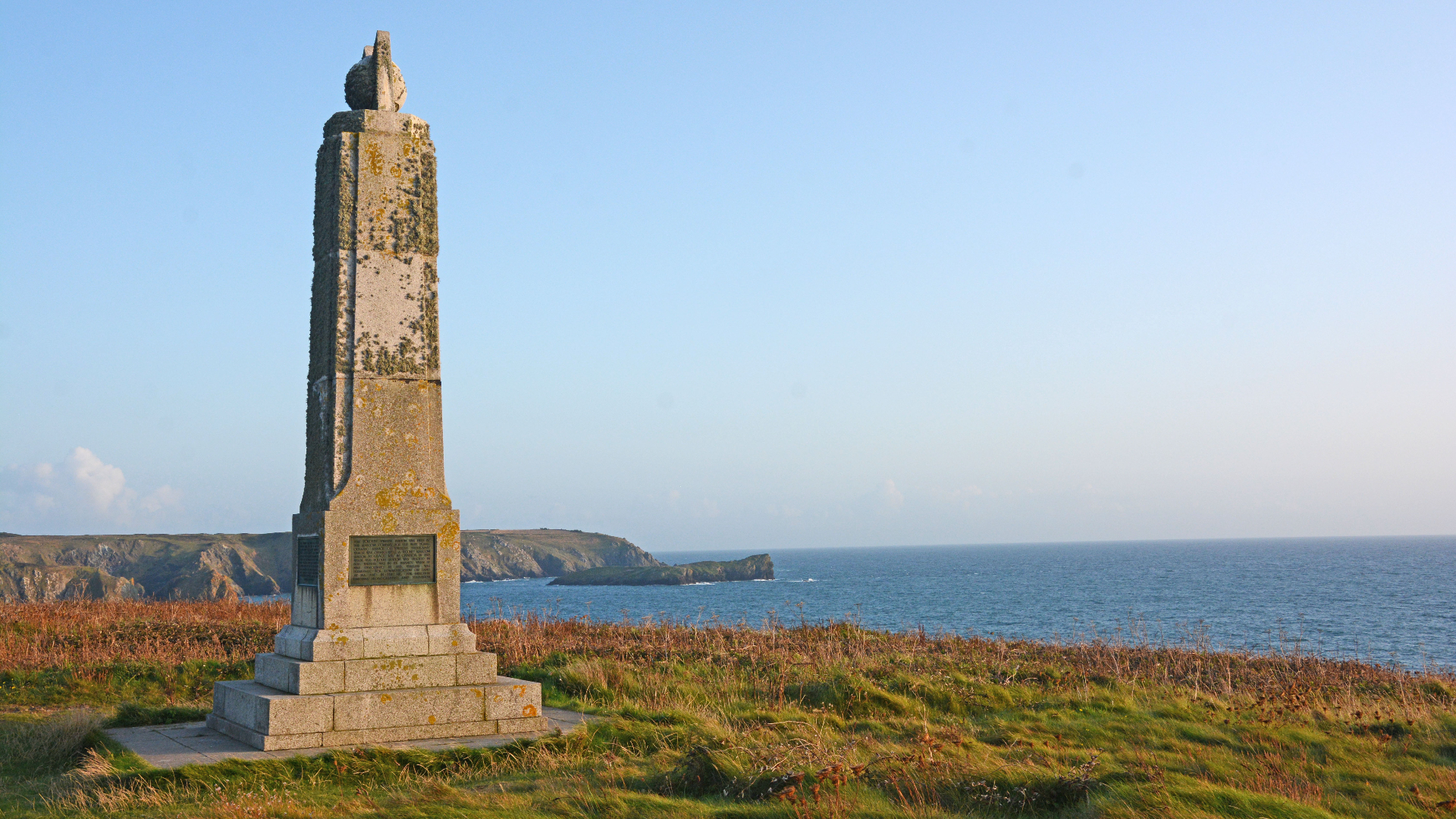
Cross the beach (a favourite with surfers), pick up the path opposite and round the headland to Poldhu Cove, where there’s a surf school. Trace the South West Coast Path around the Old Poldhu Hotel to the Marconi monument, which commemorates that time in 1901 when Italian radio star Guglielmo Marconi made the first ever transatlantic wireless transmission from here to Newfoundland.
If you’re doing a quick out-and-back bimble, you might want to think about returning to the pub now. However, if you’re up for big day, or you’ve sorted out a car drop or lift back, continue on and mooch around Mullion Cove, Predannack Head, Vellan Head and Kynance Cliff to one of the most stunningly sights on all of our South West Coast Path walks: Kynance Cove and the blue view across the lagoon and transient plunge pools that form around the rock stacks, the Bellows, Asparagus Island, Gull Rock and Lion Rock.
8. CAPE CORNWALL
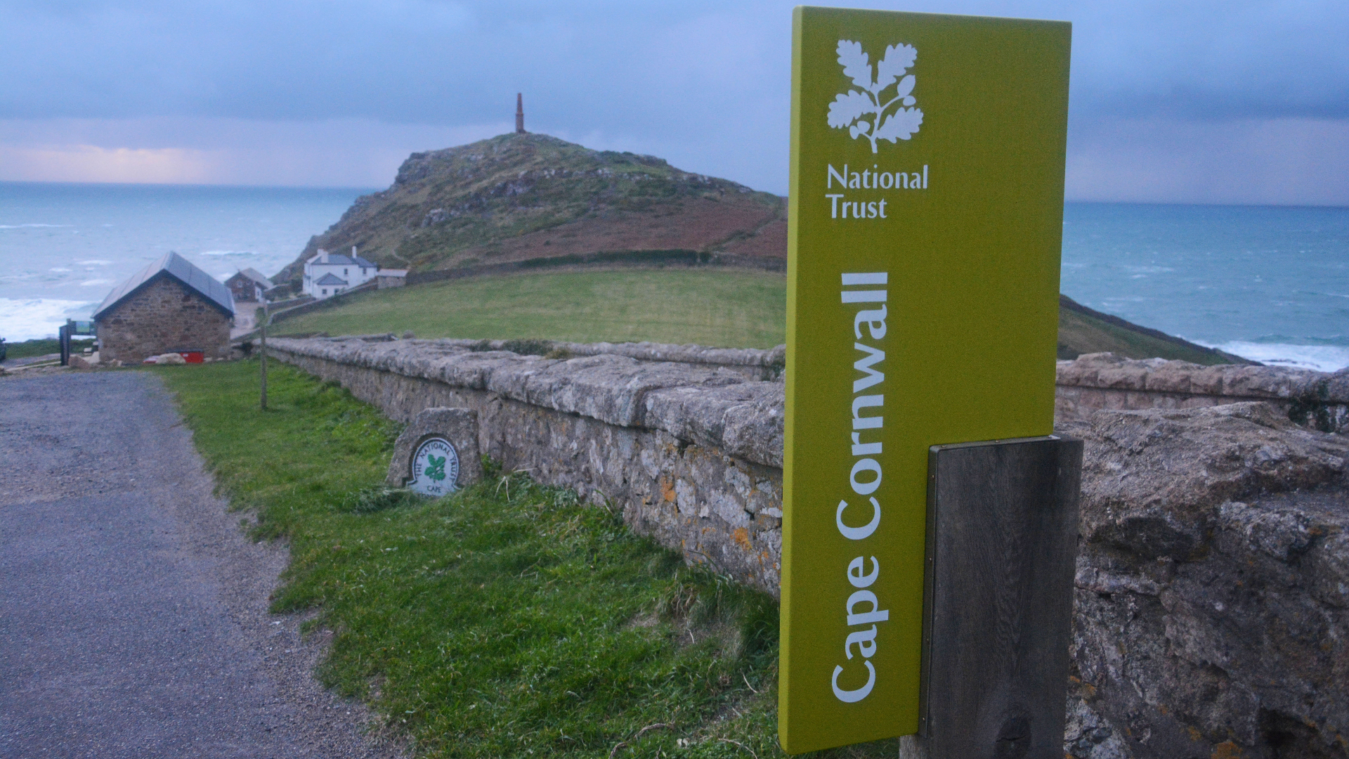
From an exposed cape to a lonely lighthouse overlooking a picturesque cove, via an Iron Age–castle, tin mines and mills, this route rambles through a landscape more Cornish than Poldark’s pants
- Distance (full return trip): 16km (10 miles)
- Ascent/Descent: 282m (925ft)
- Start/finish: Cape Cornwall National Trust car park
Sometimes known as the ‘connoisseur's Land's End’, Cape Cornwall is where the waves of the Atlantic Ocean crash into the English Channel. Until the first Ordnance Survey took place 200 years ago, it was thought to be the most westerly part of Cornwall, until Land’s End took that accolade and the resulting throngs of tourists. This is a wander on a much wilder side of the Cornish Coast, where you’re more likely to see seals than scores of other visitors. It is important to stick to the path in places, because of the existence of old mine shafts (which can be dangerous).
From the car park head out and around the cape – one of only two true capes on the British mainland, the other being Cape Wrath in Scotland), where a Lookout Station oversees the spot where the Atlantic Ocean splits asunder, with some waves going into the English Channel and others travelling into the Irish Sea and up the Bristol Channel. You’ll also see the remains of a ruined chapel, St Helens, here, and the tower of an old tin mine.
Walk north along the South West Coast Path (SWCP), past more mines, to Kenidjack Castle, where a defensive Iron Age cliff castle (built on a Bronze Age site) once glared out over the ocean. Continue, keeping the water on your left, to the sites of Botallack, Levant and Geevor mines. You’re walking through a uniquely Cornish scene here, between sea-sculpted cliffs and rock stacks on one side, and on the other the countless chimneys, towers, wheelhouses and shafts of myriad mines and mills, from a time when the tin industry employed thousands of people. Together with Cape Cornwall, this is part of a UNESCO World Heritage Site, the Cornwall and West Devon Mining Landscape.
Keep going towards the flashing light of Pendeen Watch Lighthouse, which has been beaming across the tempestuous sea here since 1900. Even the lighthouse didn’t save the MV Alacrity, which was wrecked right here in 1963, spilling its cargo of razor sharp anthracite all over the beautiful beach at Portheras Cove. It took until 2004 before the remnants of this accident was fully cleaned up, but now the cove is a lovely spot to explore. From here, either return to the beginning, retracing your footsteps along the South West Coast Path, or head inland (as indicated) to grab a pie and pint in one of the old mining pubs in Pendeen or Trewellard.

Author of Caving, Canyoning, Coasteering…, a recently released book about all kinds of outdoor adventures around Britain, Pat has spent 20 years pursuing stories involving boots, bikes, boats, beers and bruises. En route he’s canoed Canada’s Yukon River, climbed Mont Blanc and Kilimanjaro, skied and mountain biked through the Norwegian Alps, run an ultra across the roof of Mauritius, and set short-lived records for trail-running Australia’s highest peaks and New Zealand’s Great Walks. He’s authored walking guides to Devon and Dorset, and once wrote a whole book about Toilets for Lonely Planet. Follow Pat’s escapades on Strava here and Instagram here.

