
I’m a relative novice to using hiking apps and GPS navigation on the trails, but after being introduced to AllTrails last year, I’ve become a bit of a convert, using it to find new hiking and trail running routes all over Scotland, England, Greece and the Alps. So when I heard that Apple Maps was muscling in on hiking apps’ turf and introducing a custom hiking route function with iOS 18.3, I decided to give it a go.
Here in the UK, Apple Maps doesn't yet show topographical details like it does in the US, but the custom route function is available, so from the comfort of my couch, I startec searching the hills of western Scotland to build a route.
I figured mapping a route somewhere I was unfamiliar with would give me the most realistic experience, but I also wasn’t keen to die for the sake of an article – let's not forget last year’s spate of hikers who were rescued from "clearly dangerous" cliffside after following a non-existent Google Maps trail. There’s also been quite a bit of snow above 2,000ft on my last few hikes which does make it easier to get lost, so I finally settled on some low-lying hills in Loch Lomond National Park that I’ve been meaning to check out for a while.
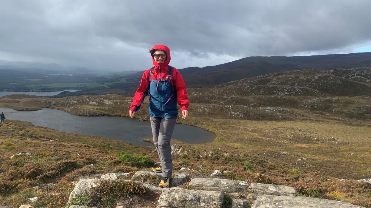
Fast forward a few weeks and I was on the trail, following a route I’d created on my phone in Loch Lomond National Park. It wasn’t a total disaster, and spoiler alert, I didn’t need to call mountain rescue, but let's just say there are a few reasons why I probably won’t use Apple Maps again.

1. Off to a false start
It turns out that with Apple Maps, you can’t plot a route just anywhere – if there are no existing paths where you want to go, you’ll get a message telling you to tap closer to a path or road. That put my mind somewhat at rest since I assume it at least reduces my chances of falling into a ravine from a non-existent trail.
After a few false starts, I found a path delineated by a dotted line just like on a topo map – part of the John Muir Way, a 134-mile path that crosses the midsection of the country. I tapped on a nearby glamping business where I assumed I’d be able to park and set that as my starting point and began creating an 8.3-mile hike that joined up several trails.
The next day it was grey but dry, so I pulled on my Columbia Konos TRS hiking shoes which are ideal for non-technical hikes and hopped in the car, using Apple Maps to get me to my starting point. About 30 minutes later I was heading up a one-lane country road where I realized my first problem: there was no parking. Driving to the nearest town wasn’t a great option, as it would add miles to my walk, most of it along a road, which I didn’t relish the thought of.
This isn’t Apple Maps’ fault – it’s on me as the user to do my research after all. But it highlighted one of the limitations of using iOS to plot a route – it really works best when you start at an established trailhead, or in a National Park, and then you arguably don’t need the app since there are likely to be maps and trail signs.
Undeterred, I drove on and after another 10 minutes, I found a parking spot and trail signs indicating that this was an access point to the John Muir Way. Fortunately, I had enough cell service to quickly create a new route and download it onto my phone, then I could switch on Airplane mode to save battery and within a few minutes, I was making my way up a moderately steep forest track.

2. I’m not confident in its accuracy
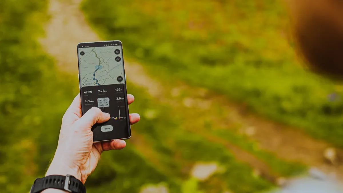
My route promised me a 5.2-mile hike, which sounded ideal, but it also estimated it would take me three hours to complete, which sounded like a lot, and turned out to be about double the time it took me. This wasn't the only time I found it to have accuracy issues.
The day before, I tried plotting a circular route up a mountain I hike regularly as a test. At just over seven miles, it typically takes me a little less than three hours to hike. But once I’d plotted it out, iOS seemed to think it was 14 miles and would take me closer to 10 hours. Big difference.
Back on the trail, after I’d been walking for a while I was pleased to see that, much like when you’re driving in traffic, my ETA started to adjust, but I can imagine less experienced hikers being discouraged by the thought of a 10-hour hike that might only take them four hours. Obviously asking how long a hike will take is like asking how long is a piece of string, but for comparison, I usually find AllTrails reasonably accurate.
As for distance, my Coros Pace 3 clocked my walk at 4.7 miles, which is about half a mile difference. Apple Maps did include two unexplained little spurs it wanted me to follow and then backtrack, which I declined, so it's probably not far off, but I’d be hesitant to trust it for longer unknown routes.
3. No detours available – except one I didn’t want
Often when I’m hiking, I like to take detours. Just last week, I climbed up a new hill in the Ochils of Central Scotland that I’d found using AllTrails. The plan was an out-and-back hike but when I reached the top, my map showed another trail I could take that would take me over another summit to make a loop. On a clear day, I might have been able to figure this out without technology, but I was in a cloud, so it was thanks to the map that I felt confident to continue on.
On the John Muir Way, I reached the first trail junction after about a mile and pulled out my phone to see which direction I should go. Here I got the biggest surprise of all – once you hit Go and start hiking, Apple Maps doesn’t seem to recognize any other possible routes. It just indicates the route you’re following with a blue line. It was clear which way I should go, and I understand that the point is to take the effort out of navigation, but I can’t help but think that when you’re out on a hike, it’s helpful to know as much as possible about your surroundings.
This also meant I later took a wrong turn. Towards the end of my hike, I was heading downhill when the path split. As before, my app didn’t indicate the presence of another option, so I guessed and I was wrong. Shortly I found myself without a trail, picking my way through a deforestation project when Siri’s voice came out of the pocket of my jacket telling me to return to the route. It’s great that I got a wrong turn alert, but what I actually wanted was a more detailed map so I could have made the right decision from the start.
I’m not knocking the GPS or navigation – there was actually a pivotal moment in my hike where I’d have missed a righthand turn without the app, but I’d like to know more about what’s around me in case I want to go exploring or change my plans.
4. Other apps do it better
“You have arrived,” Siri informs me unhelpfully as I get back to my car, unscathed but looking forward to getting back to hiking without that voice in my pocket.
As John Muir himself once said, in every walk with nature we receive far more than we seek, and as always I’ve benefitted from my time outdoors. There are even aspects of Apple Maps I quite like. The map stays on the home screen of my phone rather than disappearing into the background when I open my camera to take photos – something that does happen with AllTrails. And I like that the routes are downloadable and therefore available when I’m offline, or out of cell service.
In fairness, I probably pushed iOS 18.3 to the limits with what I was asking it to do – it’s really meant for hiking on well-established trails and in National Parks. But the crux of all this for me is that if you want to hike with a navigational app, loads already do it better: AllTrails+, Strava, Komoot, Garmin and Trailforks to name a few.
I’m sure that Apple’s land grab is just the start of a plan to develop this feature and make it more accurate and useful, but other apps are years ahead of them in terms of development. Apple Maps is great for getting you to the trailhead, but once you’re there there are better ways to navigate, whether that means GPS or a good old-fashioned map and compass.
How to plot a hiking route using Apple Maps
- Open the Maps app on your phone or other device
- Select a starting point by tapping on a road, path, or trail to drop a pin
- Tap on More and select Create Custom route
- Build your route by tapping or clicking on other points you wish to visit
- Choose whether you want to to go out and back, make a loop, or reverse the route
- Save the route with a name
- To navigate to the trailhead, tap Directions
- To start turn-by-turn directions, tap Go

